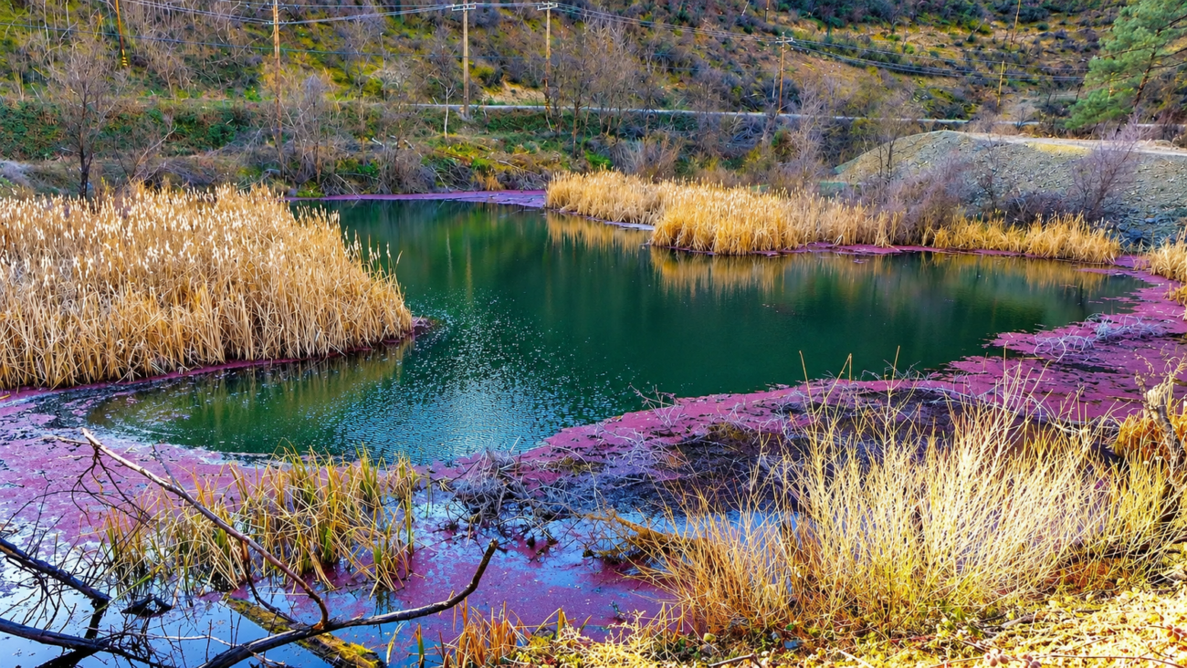
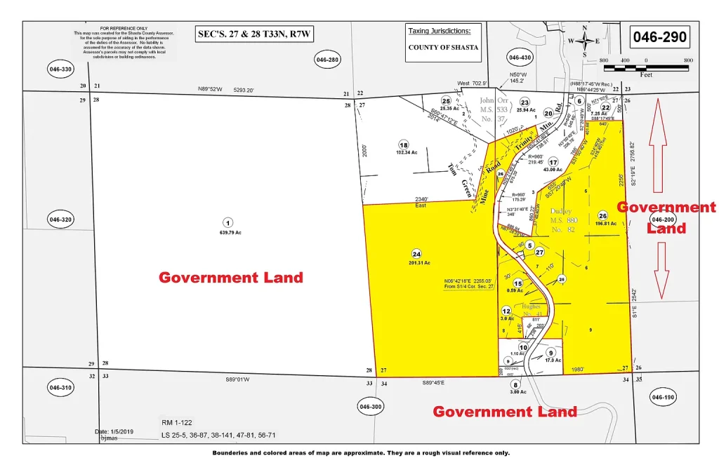
Rarely does an expansive mountain land holding combining massive acreage, rich California Gold Rush history, and absolute public land enclosure enter the Northern California real estate market at this price point. Situated in the scenic Shasta County foothills just 15 miles west of Redding, 0 Trinity Mountain Rd, French Gulch, CA 96033 spans an impressive 398 contiguous acres of rugged, historic, and highly versatile mountain terrain. Offered at an asking price of $299,000, this listing presents a rare market opportunity with a cost basis of roughly $751 per acre—a price point virtually unheard of for California land possessing year-round surface water, paved road frontage, and immediate utility access.
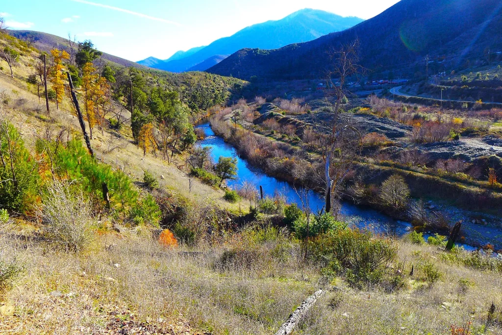
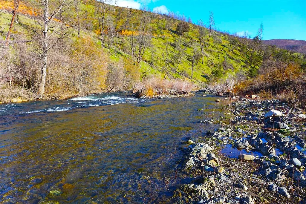
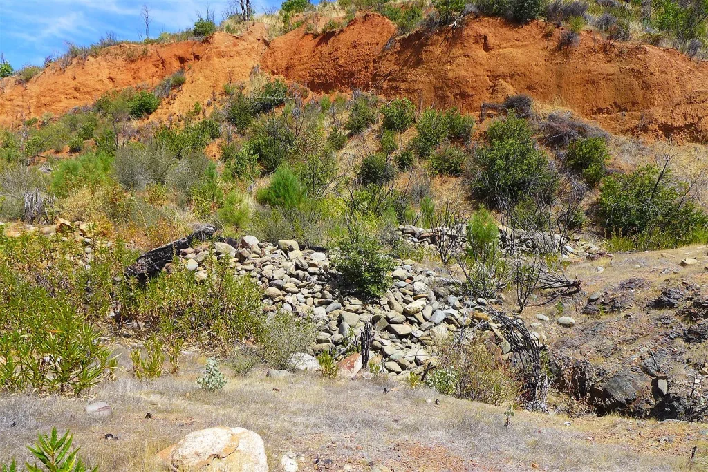
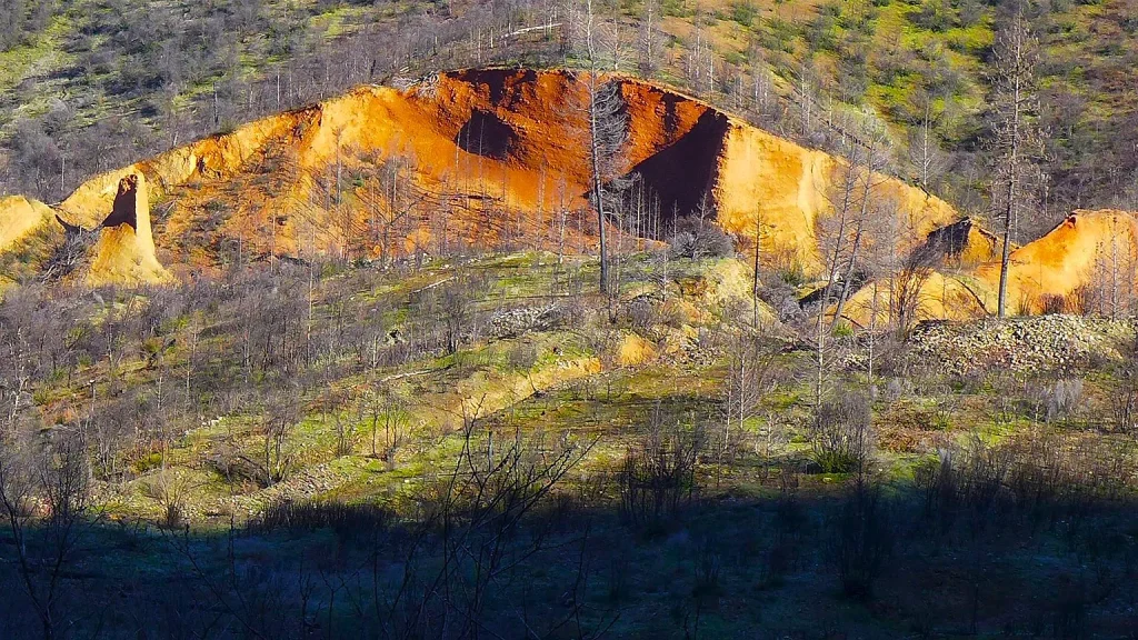
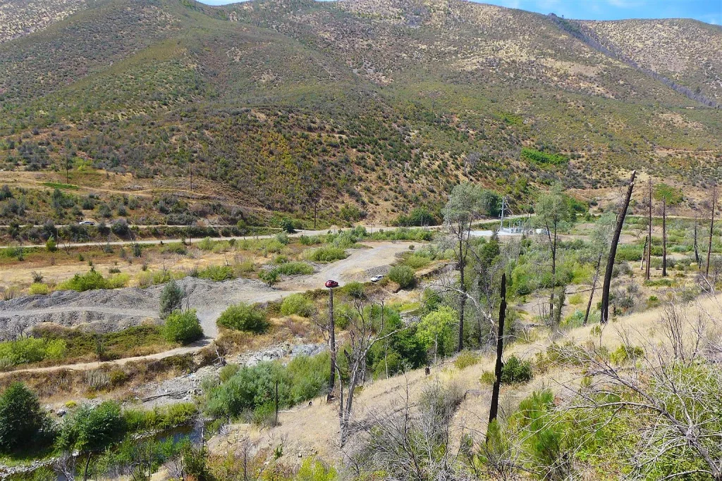
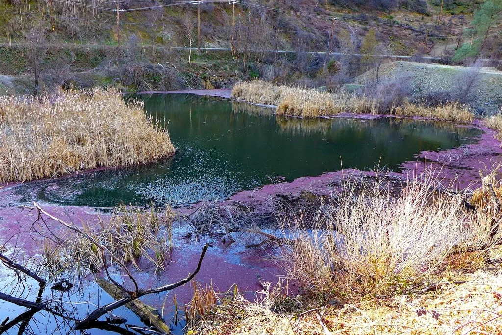
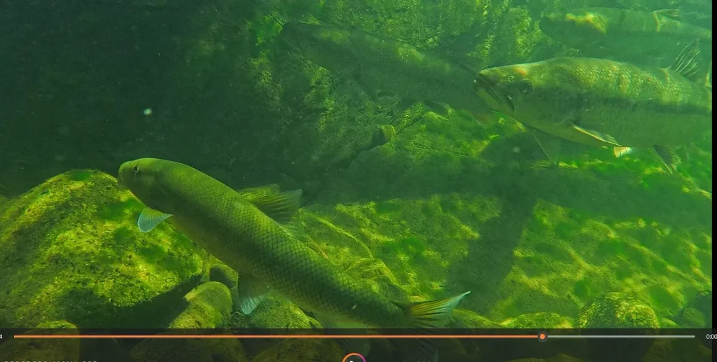
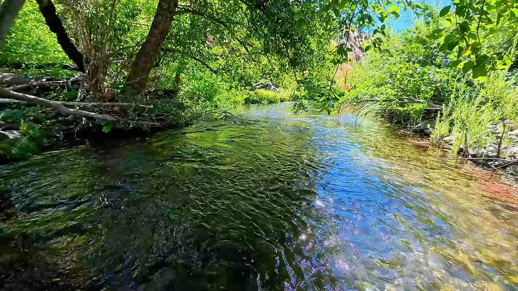
Encompassing approximately a half-mile of historic Clear Creek frontage, the parcel sits directly in the heart of the legendary French Gulch mining district—one of Northern California’s top historic quartz and placer gold-producing regions. The acreage features documented historical mining infrastructure, including the Dudley Mine site, portions of the Hughes Mine, and legacy river gravel tailings from 19th-century operations.
Bordered on three distinct sides by over 72,000 acres of combined federal public lands (managed by the Bureau of Land Management and the National Park Service), this property serves as an effectively unlimited private reserve. Whether envisioned as a private off-grid compound, a recreational gold prospector’s sanctuary, an outdoor hunting and wilderness retreat, or a long-term land-banking asset, this 398-acre footprint provides an exceptional blank canvas.
Core Property Specifications & Listing Snapshot
Below is a comprehensive structural breakdown of the core legal, physical, geographic, and utility metrics defining the property at 0 Trinity Mountain Rd, French Gulch, CA:
- Property Address: 0 Trinity Mountain Road, French Gulch, CA 96033
- Assessor’s Parcel Number (APN): 046-290-026-000
- County & Region: Shasta County | Region: French Gulch / Whiskeytown Lake Basin
- Current Asking Price: $299,000
- Total Acreage Footprint: 398.00 Acres (Single large contiguous block)
- Price Per Acre Valuation: ~$751 / acre
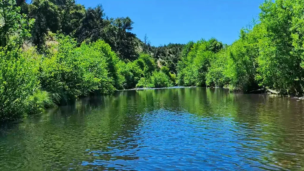
- Water Features & Frontage: ~0.5 Miles (~2,640 linear feet) of Clear Creek Frontage
- Historic Structures/Mines: Dudley Mine site, sections of Hughes Mine, and historic placer tailings
- Topography Profile: Dynamic elevation gain ranging from 1,300 ft to ~2,600 ft (Level creek flats, rolling benches, steep mountain slopes, high ridgelines)
- Adjacent Public Lands: ~31,000+ acres of BLM Land (2 borders) + ~41,000+ acres of National Park Service Land (1 border)
- Access Road Surface: Paved County Asphalt (Trinity Mountain Rd bisects the parcel)
- Power & Electrical Utilities: Adjacent active PG&E power station with recorded line easements
- HOA / POA Dues: $0 / Month (No Homeowners Association restrictions)
- Date Listed on Market: September 18, 2026
- Accepted Purchase Terms: Cash, Owner Carry 1st Trust Deed, or Owner May Carry Flexible Terms
- Ownership Entity Status: Held in Trust / Corporate Entity
Historical Gold Mining Legacy & Mineral Rights Analysis
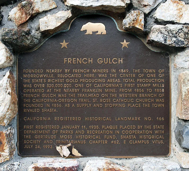
The town of French Gulch was established in 1849 by French prospectors shortly after James Marshall’s initial gold discovery at Sutter’s Mill. French Gulch quickly emerged as one of the richest and most productive lode and placer gold districts in California, producing tens of millions of dollars in gold throughout the 19th and early 20th centuries.
1. On-Site Mine Features & Placer Deposits
- The Dudley Mine & Hughes Mine Workings: This 398-acre parcel contains documented underground shafts, adits, surface cuts, and waste rock deposits tied to the historic Dudley Mine and portions of the Hughes Mine. These lode mines targeted high-grade quartz veins carrying native gold.
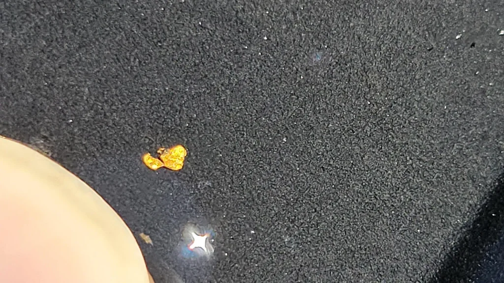
- Clear Creek Placer Tailings: Over a half-mile of Clear Creek winds through the lower portion of the property. The stream bed and adjacent gravel benches retain visible legacy tailing piles left by early miners. For modern recreational prospectors, this half-mile stream segment offers opportunities for panning, sluicing, and high-banking for fine dust and coarse nuggets washed down from upstream veins during high winter flows.
2. Mineral Title & Patent Reservation Breakdown
- Federal Patent Reservations: Per title records, certain mineral rights were reserved by the United States Government under the original land Patent.
- Rights Allocation Rule: Any minerals that were claimed to exist or were discovered and documented prior to the issuance of the original land Patent remain reserved to the federal government. Conversely, any mineral deposits discovered or claimed after the issuance of the Patent conveyed directly with the fee-simple title to the landowner.
Adjacent Public Lands & Boundary Advantage
The single most valuable feature of this property’s geographic footprint is its seamless connection to surrounding federal lands. With public land bordering three of its primary boundaries, the property functions like a private holding in the middle of a national park.
- Bureau of Land Management (BLM) Boundaries (Two Sides): The parcel shares two full property lines with over 31,000 contiguous acres of BLM land. This provides instant access to thousands of acres of public terrain for hiking, off-road vehicle (OHV) trail riding, horseback riding, and seasonal wildlife hunting without ever driving to a public trailhead.
- National Park Service (NPS) Boundary (One Side): The third property line borders over 41,000 contiguous acres of National Park Service land managed as part of the Whiskeytown National Recreation Area. This permanent border guarantees that no commercial or residential subdivisions will ever encroach on your perimeter views or natural solitude.
Regional Recreation & Proximity Highlights:
- Whiskeytown Lake (5 Minutes South): Located just down Trinity Mountain Road, Whiskeytown Lake is renowned across Northern California for crystal-clear waters, powerboating, sailing, kayaking, paddleboarding, water skiing, and public sandy beaches.
- Famous Waterfall Trail Networks: The surrounding parkland contains four famous waterfall trails: Whiskeytown Falls, Crystal Creek Falls, Brandy Creek Falls, and Boulder Creek Falls—all within minutes of the property.
- Redding Commercial Hub (15 Miles East): A brief 20-minute drive along Highway 299 brings you into Redding, the major commercial center of Shasta County, offering hospitals, Redding Regional Airport (RDD), major retail hubs, and dining.
Topography, Elevation Profile & Fire Recovery Context
Terrain Diversity & Elevation Gain
- Elevation Spectrum: The terrain rises from 1,300 feet above sea level at the bed of Clear Creek to nearly 2,600 feet along the upper ridgelines.
- Paved Road Bisect: Trinity Mountain Road passes directly through the parcel, dividing the 398 acres into two distinct eastern and western mountain flanks. This paved access eliminates the need to maintain miles of private dirt roads just to reach your property line.
- Build Site Potential: While significant acreage consists of steep mountain slopes suited for wildlife habitat and watershed protection, gentle benches, elevated building knolls, and level creek-side flats exist along the lower road frontage and ridge access points.
Post-Fire Ecological Regeneration
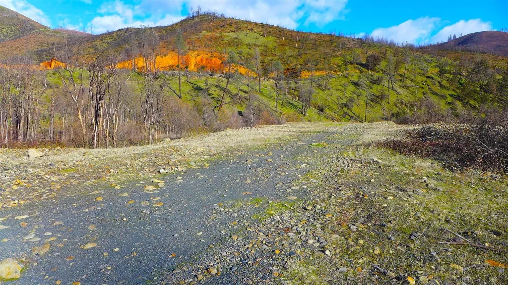
The property was located within the perimeter of the historic 2018 Carr Fire. In the years following the event, the local mountain ecosystem has undergone impressive natural recovery:
- Vegetation Renewal: Native chaparral, manzanita, oak re-sprouts, and brush species have fully stabilized the soil and prevented erosion across steep slopes.
- Tree Canopy Growth: Fast-growing broadleaf species such as Black Oak and Pacific Madrone, along with young pine saplings, are re-establishing canopy cover across the benches and drainages.
- Improved Sightlines & Panoramic Views: The clearing of thick brush understory has opened up unobstructed 360-degree vistas across the Trinity Mountain range, the Whiskeytown basin, and distant Shasta County peaks.
Utility Infrastructure, Building Regulations & Development Potential
- Electrical Power Availability: Unlike most remote 300+ acre mountain tracts that require costly off-grid solar or long utility pole extensions, this parcel features an active PG&E power station located directly adjacent to the property boundary. Recorded utility easements cross portions of the land, providing a rare and cost-effective path to connect standard grid electricity.
- Water & Wastewater Strategy: With ~2,640 linear feet of year-round water flow along Clear Creek, surface water is available for agricultural or livestock purposes. For residential construction, drilling a private water well into underlying fractured rock aquifers is standard practice in Shasta County. Wastewater requires a standard private septic system.
- Shasta County Building Guidelines: Being unimproved raw land with no strict HOA rules, owners have maximum freedom regarding property use, including single-family residential homes, cabin retreats, agricultural outbuildings, barns, and recreational camping.
Comparative Market Valuation & Regional Investment Benchmarks
| Property Metric / Valuation Attribute | Subject Parcel (0 Trinity Mountain Rd) | Regional Shasta County Land Averages | Strategic Advantage / Investment Analysis |
| Total Asking Price | $299,000 | $350,000 – $650,000+ | Highly competitive entry price for nearly a square mile of land |
| Price Per Acre | ~$751 / Acre | $1,800 – $4,500 / Acre | Substantial 60% to 80% discount per acre compared to regional norms |
| Total Acreage Footprint | 398.00 Acres | 20 – 80 Acres (Typical) | Nearly 5 to 10 times the acreage size of average rural listings |
| Surface Water Assets | ~0.5 Miles of Clear Creek | Dry / Seasonal Creeks | Direct ownership of a major, year-round gold-bearing stream |
| Public Land Enclosure | 3 Borders (~72,000 Acres) | Single Border or None | Unmatched recreational privacy with zero development risk on 3 sides |
| Road Access Quality | Paved Asphalt Frontage | Unpaved Dirt / 4WD Only | Year-round access directly off a maintained county asphalt road |
| Power Infrastructure | Adjacent PG&E Station | Miles to Grid Power | Substantially lowers utility connection costs compared to off-grid land |
| Financing Options | Seller Financing Available | Cash Only or Bank Loans | Bypasses strict institutional land lending requirements |
Comprehensive Pros vs. Cons Analysis
Pros (Core Investment Drivers)
- Exceptional Value Basis: At ~$751 per acre, it represents one of the lowest per-acre entry points in California for land with paved access and utility proximity.
- Significant Water Frontage: Half a mile of year-round water flow along historic Clear Creek.
- Direct Border Access to 72,000+ Public Acres: Surrounded on three sides by BLM and National Park Service lands.
- Gold Rush Heritage: Contains historic lode mines (Dudley and Hughes) and placer gravel deposits for recreational panning.
- Paved Access & Grid Power Access: Paved asphalt road bisects the parcel, with an active PG&E power station bordering the property line.
- Prime Location: Located 5 minutes from Whiskeytown Lake and 20 minutes from downtown Redding.
- Owner Financing: Seller carry terms provide flexible financing without bank hurdles.
Cons (Important Factors to Consider)
- Steep Terrain Profile: A large percentage of the 398 acres features steep mountain slopes, limiting the total buildable footprint to select benches and lower flats.
- Mineral Patent Reservations: Commercial mining operators must conduct thorough title research regarding historical federal patent mineral reservations.
- 2018 Carr Fire Area: Forest consists of young active regrowth rather than dense mature timber canopy.
Final Verdict & Investment Recommendation
0 Trinity Mountain Rd, French Gulch, CA 96033 is a standout California land offering. Delivering 398 acres with half a mile of Clear Creek frontage, documented historic gold mines, paved road access, adjacent PG&E power, direct borders with 72,000+ acres of public land, and flexible seller financing for $299,000, it stands out as a premier mountain land opportunity in Shasta County.
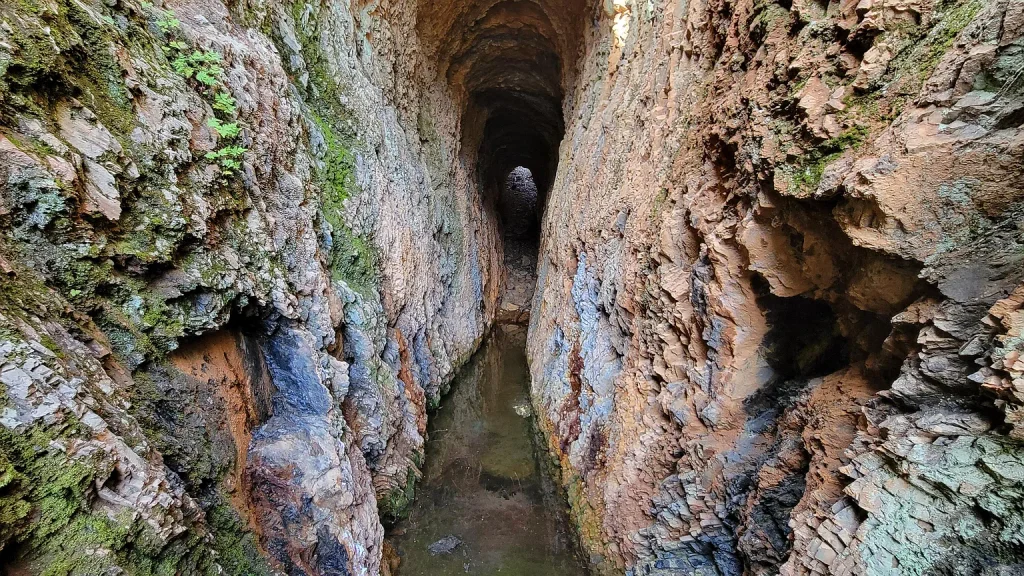
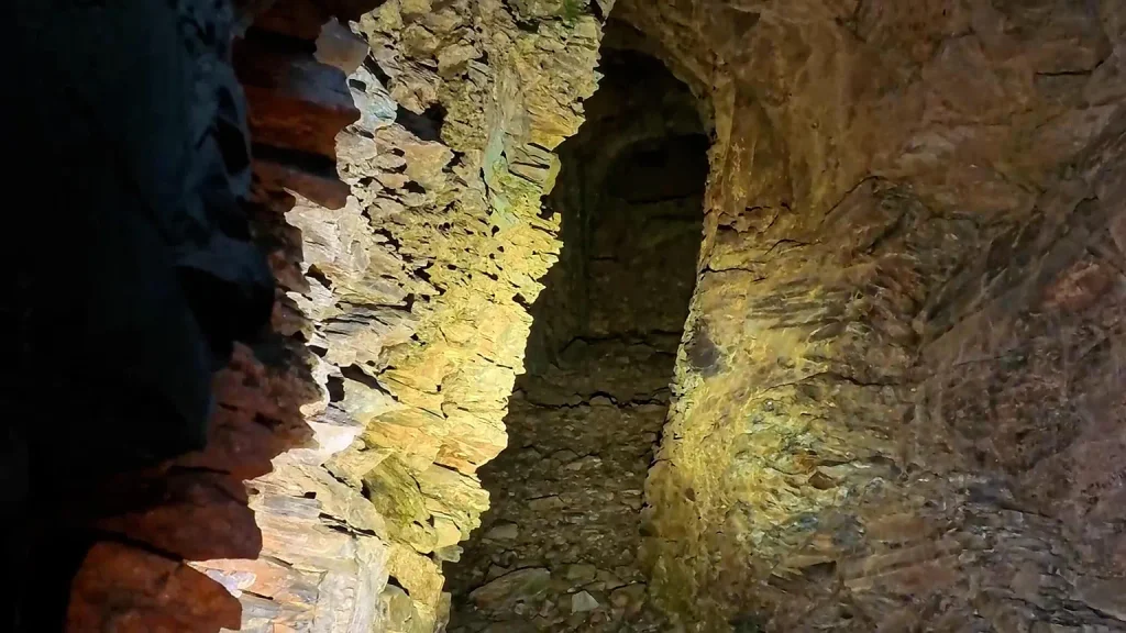
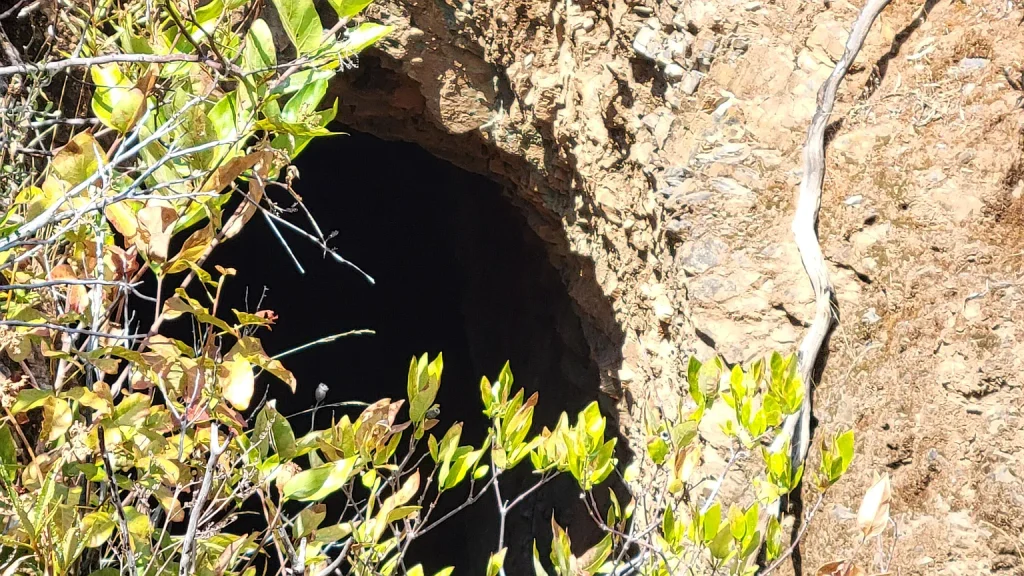
Please Note: This property contains historic underground mining shafts and adits. Prospective buyers are urged to exercise extreme caution during physical land inspections and stay on established trails. Buyers are also encouraged to complete title research on historical federal mineral patent reservations and consult with Shasta County Building & Planning regarding build site approvals.
Listed on Zillow
